Pacific plate unified based on the velocity structures by seismic tomography, seismicity, focal mechanisms.
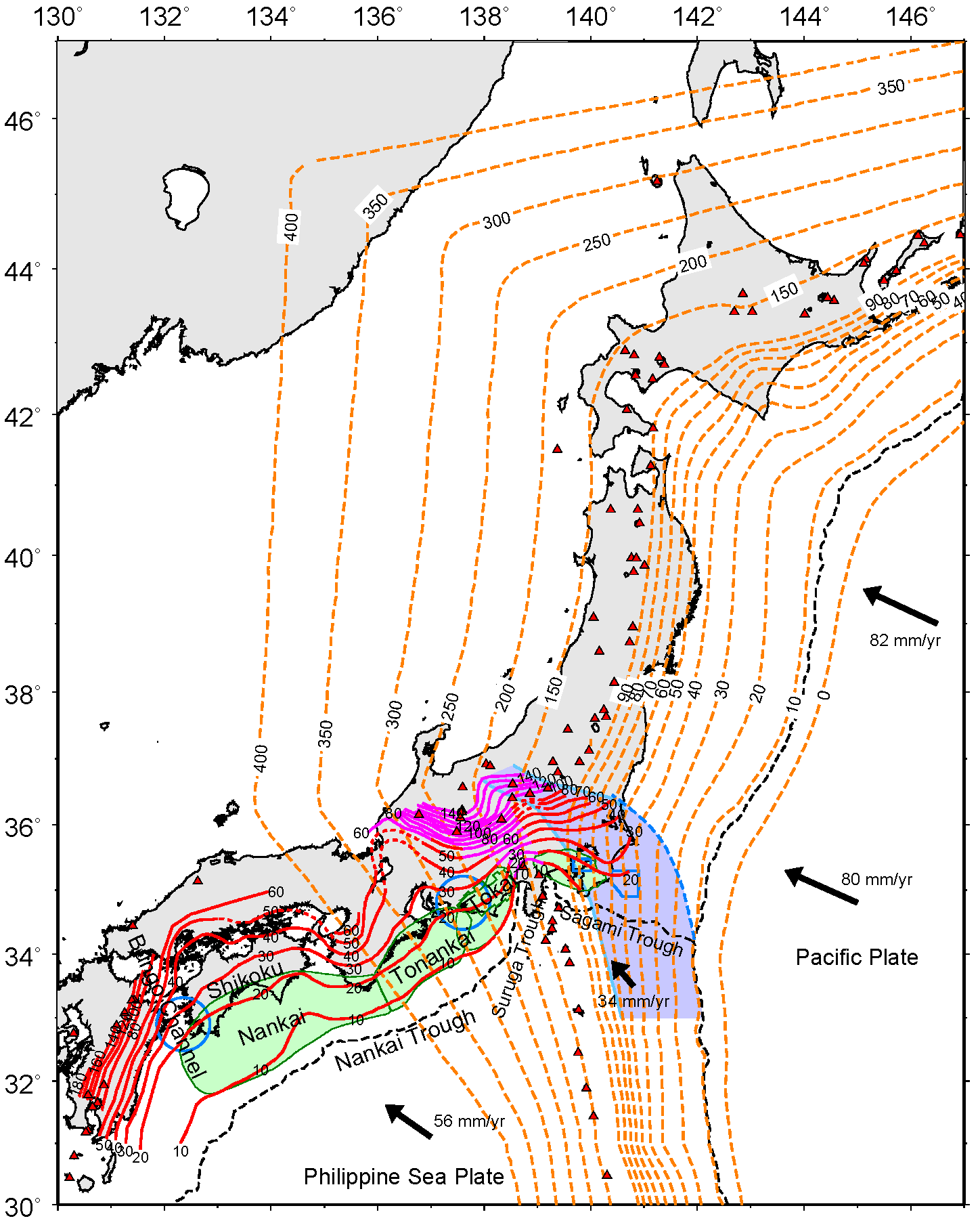
Figure 1. Depth contour map of the upper boundary of the Philippine Sea and Pacific slabs.PDF
Please refer to PHS about the Philippine Sea slab.
Pacific plate:
Data of Hokkaido district - northern Tohoku district1, northern - southern Tohoku district2, and Kanto district - northern Izu arc3 are compiled.
Broken blue line denotes the northeastern limit of the Philippine Sea slab4.
Blue masked area denotes the contact zone between the Philippine Sea and Pacific slabs3.
Arrow indicates direction of plate motion of the Philippine Sea and Pacific plates relative to the continental (Eurasian, Amurian, and Okhotsk) plate5.
*Note:
The plate configuration reflects the depth of the trench. Therefore, the trench almost accords with the iso-depth contour of 10 km at deep Izu-Bonin trench. Depth contour of 0 km on the Pacific plate is a temporary thing in the illustration.