Aerosol lidar
Aerosol lidar measures the vertical distribution of stratospheric aerosols originating
from large volcanic eruptions and forest fires that can affect the Earth's climate. By using the data, we are studying long-term variation of the stratospheric aerosol and its impact on climate change, and validating the Earth system model (MRI-ESM).
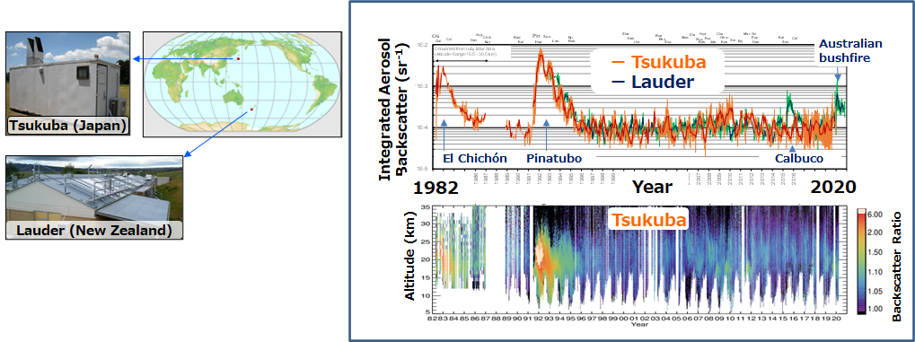
Observational data: aerosol backscattering coefficient and depolarization ratio at 532 nm (between altitudes of 0.1 and 35 km)
Location and period: Tsukuba (36°N, 140°E) 1982–2021, Lauder (45°S, 169°E) 1992–2021
Reference: Sakai, Uchino, Nagai, Liley, Morino, Fujimoto, J. Geopys. Res. (2016)
Please email ngmn11ts@mri-jma.go.jp for more information about the data and collaborative research using the data.