Water vapor lidar
Water vapor lidar measures the vertical distribution of water vapor mixing ratio in the lower atmosphere. We are studying the mechanisms of localized heavy rainfall and torrential rainfall, and attempting to improve the accuracy of forecasting using the observational data.
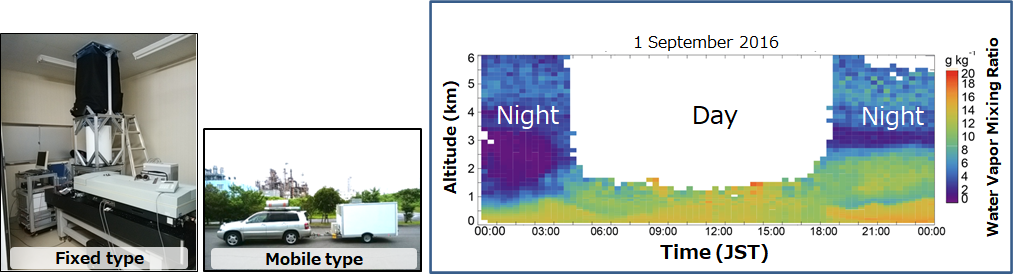
Observational data: water vapor mixing ratio between altitudes of 0.2 km and 5–6 km at night and 0.2 and 1–1.5 km in the daytime
Location and period: Tsukuba from August to December 2016, Tokyo Bay from June to October 2017–2019, and Nagasaki in Kyushu from June to October 2020–2022
Reference: Sakai, Nagai, Izumi, Yoshida, Shoji, Atmos. Meas. Tech. (2019)
Please email ngmn11ts@mri-jma.go.jp for more information about the data and collaborative research using the data.