Kobayashi (2017)は、GNSSデータの共通ノイズを低減し、1年間の傾斜期間を持つランプ関数との相関を取ることにより、南海トラフ沿い長期的スロースリップの客観検出を行った。ここではこの手法を応用し、南海トラフ沿い短期的スロースリップの客観的な検出を行った。GNSS日値および6時間値について長期トレンドを除き、1週間の傾斜期間を持つランプ関数との相関を取った。本手法により検出された時空間分布は、深部低周波地震の活発化とよく一致していた。また、Kobayashi (2017)は長期的スロースリップに伴う変位を検出したが、ここではその手法を応用して検出された長期的スロースリップの規模推定を行い、先行研究とほぼ一致した結果が得られた。
これら一連のツールを気象庁の地殻監視サーバに移植し、正常動作が確認できたことから、2021年3月から気象庁が関連資料を作成して評価検討会に提出することとなった。
要旨
Long-term and short-term slow slip events (SSEs) have occurred repeatedly in the Nankai Trough subduction zone, Japan. The SSEs may incrementally stress the adjacent parts of the locked megathrust zone. When SSEs occur, it is important to determine whether they are similar to previous repeated events, in order to judge whether the probability of occurrence of a large Nankai Trough earthquake is relatively high. In this study, we objectively detected short-term SSEs in the Nankai Trough subduction zone by correlating the GNSS daily and 6-hour coordinates with a ramp function with a one-week slope, excluding common noise and long-term trends. The spatiotemporal distribution of short-term SSEs detected was in good agreement with the occurrence of deep low-frequency earthquakes. In addition, assuming slip on a rectangular fault on a plate boundary, we estimated the moment magnitude of long-term SSEs from displacement data for two years and obtained results that were close to those of previous studies.
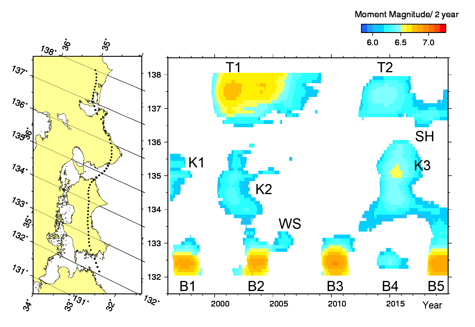
図 南海トラフ沿い長期的スロースリップの規模分布。
|