これまで南海トラフ沿いの長期的スロースリップは、GNSSデータの非定常な変位を個別に検出して発生が報告されていた。そこで客観的な基準で長期的スロースリップを検知してみた。具体的には、中国地方全体を領域固定して共通ノイズを減らし、フィリピン海プレートの沈み込みと逆方向の成分について、南海トラフのプレート等深線25km沿いに並べた地点を中心とする一定範囲内の平均を求め、1年間の傾斜期間を持つ3年間のランプ関数との相関を取った。相関係数0.6以上、期間前後の変位が2mm以上の時期をプロットすると、これまで報告されていた長期的スロースリップの他に、紀伊水道に新たな長期的スロースリップも見つかった。
要旨
This paper presents a method for objective detection of long-term slow slip events with durations on the order of years, on the plate boundary along the Nankai Trough, relying on global navigation satellite system daily coordinate data. The Chugoku region of Japan was held fixed to remove common mode errors, and a displacement component was calculated relative to the direction of plate subduction. Correlations were then calculated between this displacement component and a 3-year ramp function with a 1-year slope. Nearly all periods of strong correlation coincide with periods of previously reported long-term slow slip events. A period of strong correlation around the Kii Channel in 2000-2002 is attributed to a previously undocumented long-term slow slip event beneath the Kii Channel and the eastern part of Shikoku Island with an equivalent moment magnitude of 6.6. This detection method reveals variation among long-term slow slip events along the Nankai Trough.
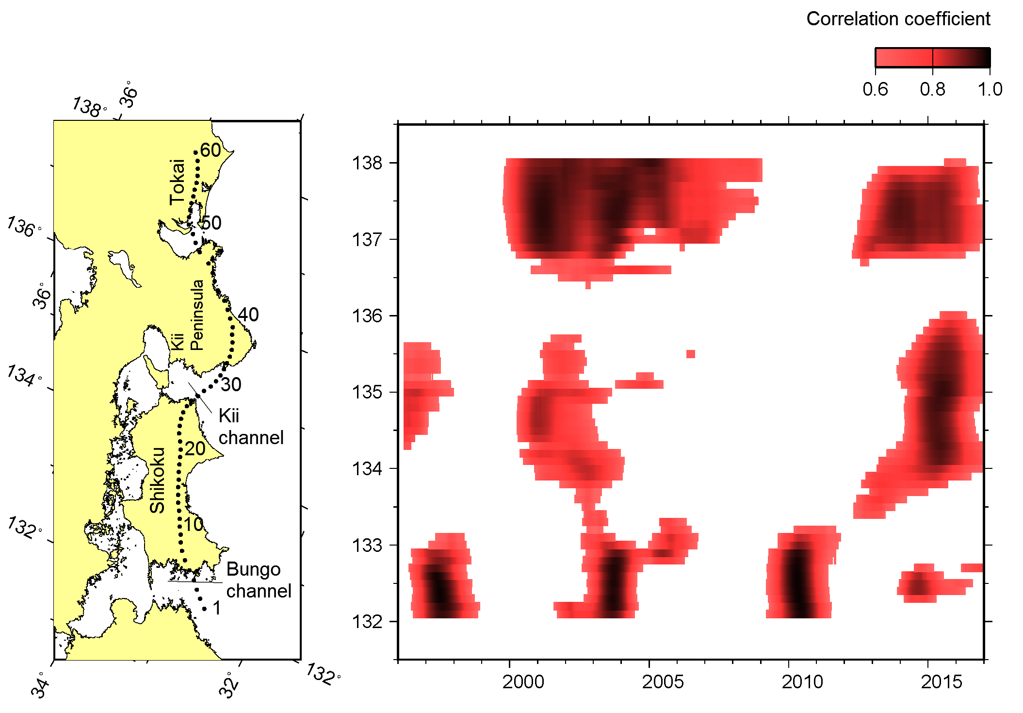
図 南海トラフ沿いの長期的スロースリップによる非定常地殻変動の時空間分布。
|