2003年の測地学会誌の論文の続編。中部地方に見られる2000年伊豆諸島北部イベント後の地殻変動を、東海地域のプレート境界上のすべりにより説明したもの。
要旨
2000年伊豆諸島北部の地震・火山活動に伴い,関東から中部地方にかけて広範囲に地殻変動が観測された。その時間的推移を調べ,東海地域から中部地方内陸部にかけて,伊豆諸島北部の変動源では説明できない地殻変動があることがわかった。この地殻変動は,東海地域のプレート境界上のすべりにより説明できる。
Transient crustal deformation occurred in the regions of Kanto and Tokai during the seismo-volcanic event in the northern Izu Islands in 2000. In our investigation of the observed deformation, we constructed an optimum-source model of the event between Miyake and Kozu Islands. We then made an inversion analysis of the differences between the observed displacement field and the calculated displacement field from the optimum model, assuming that the differences were caused by the changes in the interplate coupling beneath the Tokai region. From the inversion analysis of data for each of three-month periods, May to August, June to September, and July to October, we found decreased interplate coupling in the early stages of the 2000 event. In the first stage, either a slow slip or a temporary suspension of the plate subduction occurred in the focal region of the anticipated Tokai earthquake. The area then extended to the west, and finally, a slow slip exceeded the secular convergence velocity on the plate interface near Lake Hamana in the fall of 2000. We believe this ongoing slow slip, which was detected by Ozawa et al. (2002), began in August or early September 2000.
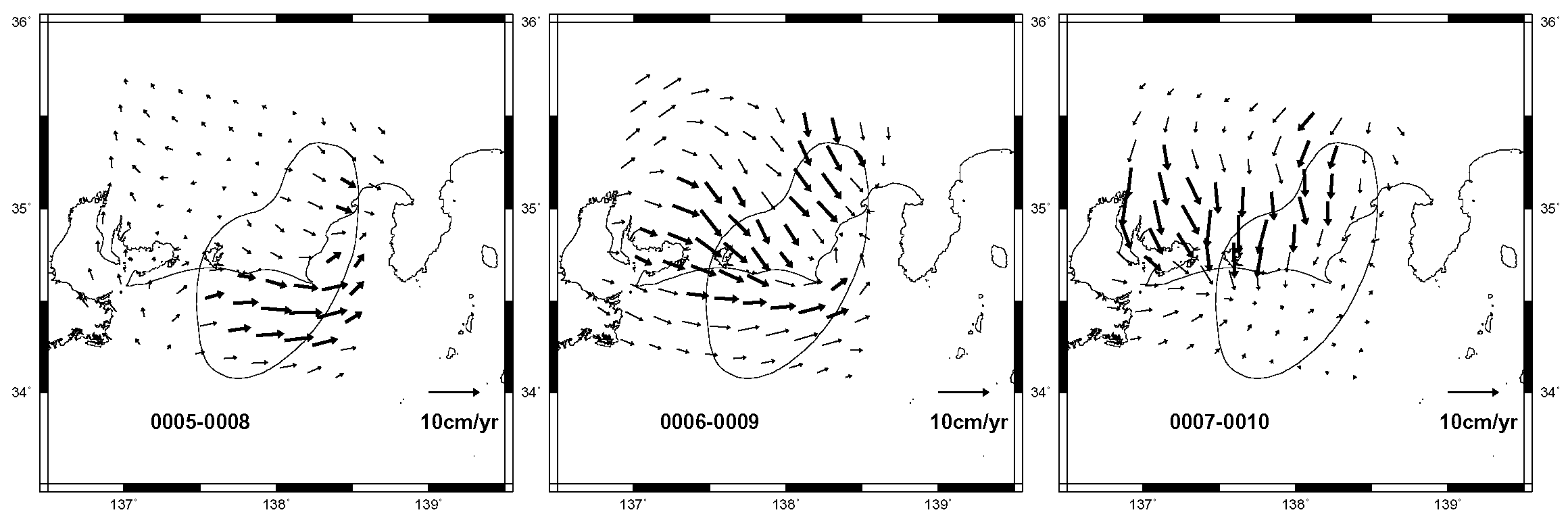
図 推定されたプレート境界上のすべり分布
|