2003年の伊豆諸島北部イベント後の中部地方の地殻変動の解析で用いたGMTによる平滑化を利用して、GPSの面的な監視手法を考案したもの。ポイントの一つは特定の観測点ではなく毎回の中央値を固定すること、もう一つはあまり細かい分布を反映しない平滑化をすること。どちらも外れ値の多い3時間値のために導入した。
要旨
東海地域のGPS3時間解析値を使った想定東海地震の前兆現象を検出するための空間的な監視手法を提案する。まず、各成分について、長期と短期それぞれの座標の中間値から変位を計算する。次に、その変位をGMTソフトウェアを使って平滑化し、得られた格子点値を評価する。この手法により、地図上で異常な変位を検出することができ、外れ値に対する安定性も期待できる。更に、GPSの日解析値に対しても同じ手法は有効である。
We propose a spatial monitoring procedure to detect precursory signals of the anticipated Tokai earthquake using a 3-hour analysis of the GPS data in the Tokai area. First, we calculate displacements for every component from a median coordinate for a long period and a median coordinate for the latest short period. Displacements are then smoothed using the GMT software, and grid point values after that are rated. By using this procedure, we can detect abnormal deformation on a map, and it is hoped that the stability for the outlying values can also be obtained. Moreover, the same procedure is effectively applicable to daily analysis values from the GPS.
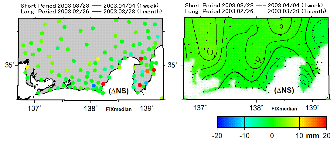
図 面的監視処理の平滑化前後の例
伊豆半島や御前崎付近の外れ値が平滑化により目立たなくなっている。
|