1999年春からGPS東海地域3時間解析値が国土地理院から気象庁に送られ始めた。東海地震予知監視のため、多少の精度を犠牲にしても速報性を求めたものであり、その精度などについて地震防災対策強化地域判定会委員打ち合わせ会で何度か報告したものをとりまとめたもの。津村・那須野(1998)を参考に観測点のノイズの相関を見たところ、きれいにグループ化された。
要旨
気象庁と国土地理院によりGPS東海地域3時間解析の運用が1998年に開始された。この解析により得られた座標値や斜距離の精度や特徴を把握するために調査を行った。この結果,3時間解析の斜距離のばらつきは1日解析の2〜3倍であること,観測点が座標値の偏差の相関が高い6つのグループに分けられ,これらが解析クラスターとアンテナ・架台タイプに対応していることが判明した。このうちアンテナ・架台タイプによるものは,2001年7月の新解析システムの導入によりグループ化が解消した。
Geographical Survey Institute and Japan Meteorological Agency have operated a
monitoring system for crustal deformations in the Tokai area since 1998, which has
performed a baseline analysis using 3-hour GPS data. We investigated precision and
characteristics of the coordinate and the baseline length obtained by the analysis. The
precision of the baseline length obtained from 3-hour data is a couple of times worse
than that obtained from a daily data. Correlation of coordinate variations between
every pair of the observation stations was examined, and then the stations were
divided into six groups according to the correlation coefficient evaluated. These groups
corresponded to both analysis clusters that the station belonged to and classification of
the monument/antenna type that was adopted at the station. Alteration to the new
analysis strategy has reduced the difference of groups depended on the monument/
antenna type.
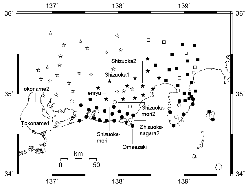
図 座標偏差の相関によりグループ化した観測点の分布。
これが基線解析時のクラスター分割、およびアンテナ・架台タイプとほぼ一致していた。
|